Information for speakers
Where:
We meet in 2112
MSB.
MSB (
the Mathematical Sciences Building
)
is located in the south part of campus, not far from the
corner of La Rue Road and California Ave.
We even have an official address on Crocker Lane.
Note-- in 2005 (?) we moved to a NEW building and are no longer in Kerr Hall.
See the
campus map
, and more details below.
When:
2:10-3:00pm
Mondays
in 2112 MSB
The seminar meets Mondays at 2 in Spring 2026.
There are other
activities and reading seminars going on you may want to
participate in if you have time during your visit.
Melissa's office is
3228 MSB , phone: ?
Melissa runs the Davis combinatorics mailing list. If you would like
to subscribe to the list, send an email to sympa at ucdavis.edu with
subject "subscribe combinatorics YourFirstName YourLastName" and no
text in the body. Alternately, email mshermanbennett at ucdavis.edu
.
Monica's office is
3224 MSB , phone: 530-754-0498
Anne's office is
3222 MSB, phone: (530) 754-0497
Matthias' office is
3143 MSB, (530) 754-0479
Fu's office is
MSB 3220 , phone: (530) 754-0496
Jesus's office is
PDSB 1013 (yes, a different building!) phone: (530)754-0502
Eric's office is
MSB 2109, phone 530-754-0306
Greg's office is
MSB 2216 , phone: (530) ??
Eugene's office is
MSB 2113 , phone: (530) 754-0307
Erik's office is
MSB 2101 , phone: (530) 754-0274
Chenchen's office is
MSB 2144 , phone: ????
Gyivan's office is
PDSB 1004
phone: ????
Click here to see the
local weather
in Davis.
(All of this information can be found at
https://www.math.ucdavis.edu/about/directions/
.)
Airplane: The most convenient airport is
Sacramento (SMF) which is 30 minutes by car from the Davis campus.
(Unless you are spending time in the Bay Area, avoid flying
into SFO or OAK - go straight to SMF.) The Davis
Airporter limousine service [telephone (530) 756-6715] runs
between Davis and the Sacramento airport, costs around $?? (the
site says can be as little as $25).
https://www.davisairporter.com/
(Save your receipts!)
(See also
https://daviswiki.org/Davis_Airporter
)
These days most people take a Lyft or Uber instead of the Airporter.
The price varies by time of day, maybe $30-$50??
The Yolo bus
https://daviswiki.org/Yolobus
is also a GREAT cheap alternative, but only runs hourly
which might make it inconvenient depending on your flight time.
Travel time btwn campus and airport is roughly 45 min
and only $2 (exact fare); not too bad.
Take the 42B from airport to Davis
http://yolobus.com/routes/index.php/42B
(and the 42A if you are going from Davis to airport
http://yolobus.com/routes/index.php/42A
.)
Driving and Parking:
To park on campus you need to download
the free AMP Park app on your
iPhone
.
or
Android
.
on your phone
and follow the directions.
(we no longer use ParkMobile)
See
https://taps.ucdavis.edu/aggiepark
.
To make life easier -- before leaving for Davis (1) download the
app (2) associate your car license plate to the account (3) link
a credit card. It will be less stressful to do it ahead of time
versus on arrival.
This should allow you to park in visitor
Lot 47
off of La Rue Road.
But not the A lots 46,44 unless you maybe have special reciprocity
from another UC or pay extra in the app for an A+ spot.
I just found out from Milen that lot L (in back of the parking structure that
is opposite the Mondavi center) may be a better bet -- similar distance but
more likely to have open spots.
Without a smartphone, paying for
parking on campus will be quite difficult.
But if you read the bottom of the
https://taps.ucdavis.edu/aggiepark
page, you will see how to do so from a home computer or
regular phone.
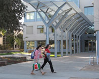
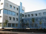
The Mathematics Department is located primarily on the second and
third floor of
MSB
pictured here.
 Here is a larger
UC Davis Campus Map.
Here is a larger
UC Davis Campus Map.
Davis is on Interstate 80, about 12 miles west of Sacramento and 75
miles east of San Francisco, and 65 miles east of Berkeley. (Depending on
how fast you drive, allow 70-100 minutes to get to Davis from Berkeley.)
- Car: Parking:
To park on campus you need to download
an app on your phone
and follow the directions.
See above.
Without a smartphone, paying for
parking on campus will be quite difficult.
There is no free parking on or near campus (or at least not
near MSB; you can park downtown for free for about 2 hours).
-
Shorter directions to Visitor Parking Lot 47 (or lot 46)
from San Francisco/Berkeley,
corresponding to the following
detailed map.
Drive on Interstate 80 East.
Continue on I-80 and exit at the UC DAVIS exit (it might also say
Mondavi Center or Old Davis Road) (if you hit downtown Davis/ Richardson
exit you've gone tooooo far. The exit you want is just after the 113-N).
You will go toward campus off the offramp (it's left/ north), and then after a bit
the road curves right.
You will go past a little "Visitor Information" kiosk/shack,
and just when you come level with a big ORANGE bldg on you right,
there is a big new traffic CIRCLE:
turn left (which means going around it 3π/2).
There will be a YIELD sign where you go left onto
California Ave (but I do not think it is marked, or they renamed this stretch ''La Rue").
(Don't go in the left turn lane too early at the shack, but if you don't
turn left in time, you'll have a chance to turn around. If you hit the Mondavi Center
you've gone too far).
You will go through one stop sign and after, cross over a little creek.
Make a left on La Rue. There is no stop sign here, but it does say "Davis
Loop". If you go too far it says "Not a Through Street". (On the other
hand, to orient yourself, if you were to keep driving straight, the math
building is like the 2nd building on your left.)
Lot 46
will be the first lot on your right.
Lot VP 47 is also
on your right, just after Meyer Hall, and Lot 47A is a bit farther
(but emptier).
- Alternate Directions,
corresponding to the following
detailed map.
Drive on Interstate 80 East.
Just before reaching Davis, turn north on Highway 113 North (note that you will encounter the 113 South turn-off before reaching the 113 North turn-off).
Take Highway 113 North a short distance to its first exit at Hutchison Drive.
Turn right on to Hutchison.
Drive (east) about 1/2 mile on Hutchison until you reach La Rue.
Turn right on to LaRue.
Continue on LaRue around the left bend and turn left into
Visitor Parking Lot 47.
Public transport:
The Amtrak train :
The station in Davis
is located at 840 2nd St.. From here, walk about 8 blocks west,
down 2nd Street, to campus. Then it is still a 20 minute walk to MSB. (See below)
Several faculty take the train regularly, so you might ask to
connect with one of them.
If coming from the Bay Area, you may take BART
to the Richmond
stop, exit BART and cross the platform to Amtrak, and take a
Capitol Corridor train to Davis. You may also catch an Amtrak
train in Emeryville
or the end of University Avenue in Berkeley (3rd and
University). Tickets can be purchased from a vending-type-machine
if the station has no conductor or even on the train itself
(save your receipts!). But I recommend you buy at least a one-way
online in advance; makes it easier.
Some
schedules from 2017 are here.
(Times are
subject to change
-- check Amtrak
website to be certain. Or phone 1-800-USA-RAIL (1-800-872-7245). One can
check train status at this number as well, most easily if you remember the
train number, e.g. 526. In fact, I recommend train 528 which reaches
Davis at 11:38am in 2026.)
(In 2026 the 526,528,530 Capitol Corridor trains arrive Davis at 10:34am, 11:38am, 1:19pm respectively if on time. The 545, 547,548,551 depart Davis at 4:09pm,5:17pm,7:19pm, 9:19pm resp.)
The train ride is roughly 90 minutes, and the Davis
station is quite near campus.
While it often leaves from Berkeley/Richmond on time, it can pause on the
way and get you into Davis a bit late, but still in plenty of time
for your noon talk.
The train is quite comfortable.
A possible option for going home is or was the Davis-Berkeley VanPool.
I haven't checked since 2019 that this still holds, but back then
one could:
You can show up on the spot (at a parking lot near the Music Building
, across from Shields Library) before 5:10pm and
if there is room,
pay about $12 and just ride it to El Cerrito Bart. It reaches there about 6:10pm.
In the morning it leaves from a side street
near BART at about 7 or 7:30am.
Once upon a time, There was a
UCB-UCD
shuttle, but I believe it has been discontinued, sadly.
Walking from the train to campus:
Easy to navigate with a smartphone...
From the train, walk west down 2nd street.
(or bike if you brought your bike on the train!!!)
You'll pass G, F, ... , eventually A Street. Then you will hit campus.
Getting to MSB is now slightly windy.
If you continue in pretty much a straight line, you will reach
California Ave
(En route you will pass the Quad on your left and Memorial Union
on your right).
Make a left on California and walk south for about 15 minutes.
You will pass a traffic circle and the Silo/ Bike Barn.
After that try to walk in as straight a line as possible,
keeping Bainer on your right and Roessler on your left.
The road will again become California Ave more clearly,
and MSB will be on your right, just past Crocker.
The following
detailed map
may be useful.
If you head a bit farther south when you hit E from the train station,
you can go beyond 1st
St and into the arboretum, and enjoy a tree-lined walk to MSB. Exit towrd campus when you see the water tower. If you don't know the way, do consult your phone.